

 At Sandhurst Primary School, our geography curriculum is designed to enable our pupils to gain a knowledge and understanding of the environments in which they live and the wider world around them. We want our pupils to aim high to be inquisitive and curious, and be concerned and challenge behaviours towards our planet. As a school, we want to motivate them to learn about Earth; how it is formed of vast differing physical environments and the diverse range of cultures which inhabit our globe.
During their geography learning within their topics, we aspire to support our pupils to learn through the enjoyment of a variety of experiences which include observing, collecting and interpreting information from a range of sources, as well as from practical activities of field work and visits. We aim to teach pupils about the world in which they live, learn from it and its issues, and their place in contributing towards it as British citizens. Therefore, in geography we encourage our pupils to be active, mindful learners by asking questions and reflecting on the actions of themselves and others. We aim for our pupils to show kindness towards our planet and current world issues. We aspire for them to develop an active role in taking responsibility to look after our world.
 In line with the national curriculum, we use carefully sequenced lessons, inspired by the Cornerstones curriculum. Pupils in Reception begin their geographical learning within the early years by developing their understanding of the world around them and beyond, through exploration.Throughout Key Stage 1, pupils are taught directional and positional language to describe routes around them and they will learn how to identify features from maps, draw their own maps and locate landmarks. They will explore the world’s seven continents and five oceans, the different seasonal weather types and hot and cold environments. We aim for them to develop knowledge of human and physical geography both locally and across the planet. They will build on this through Key Stage 2, where they will develop their physical geography by examining contrasting physical environments across the world to include earthquakes and volcanoes, mountains, rivers and seas. This will give them the opportunity to make progress with their mapping skills using more detailed atlases and ordnance surveys with grid references.
Pupils will explore human features of different land uses and settlements; naming cities and countries across the globe. They will find out about different climates and how the types of weather systems across the world work. Throughout our curriculum we encourage our pupils to use subject specific vocabulary and develop their reading and writing skills through geography with the use technology to research online as well as with non-fiction books.
Following the Cornerstones Curriculum, all of our main geographical projects are taught in the spring term, with opportunities to revisit geographical concepts as part of some of the autumn and summer term history projects, as well as additional geographical companion project which also run alongside the history projects.
| EYFS | |||
 |
Let’s Explore |  |
Animal Safari |
| This project teaches children about the environments that they share with others, including their homes, school and places in the local community. | This project teaches children about the animals that live around the world, how to look after animals and the importance of caring for our local and global environments. | ||
| Year 1 | |||
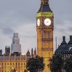 |
Bright Lights Big City |  |
Companion Project: Our Wonderful World |
| This project teaches children about the physical and human characteristics of the United Kingdom, including a detailed exploration of the characteristics and features of the capital city, London. | This essential skills and knowledge project teaches children about physical and human features, maps, cardinal compass points, and positional and directional language. They learn about the equator, hemispheres and continents and are introduced to the countries, capital cities and settlements of the United Kingdom. The children carry out simple fieldwork to find out about local physical and human features. | ||
| Year 2 | |||
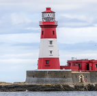 |
Coastline |  |
Companion Project: Let’s explore the world |
| This project teaches children about the physical and human features of coastal regions across the United Kingdom, including a detailed exploration of the coastal town of Whitby, in Yorkshire. | This essential skills and knowledge project teaches children about atlases, maps and cardinal compass points. They learn about the characteristics of the four countries of the United Kingdom and find out why there are hot, temperate and cold places around the world. They also compare England to Somalia. Children carry out fieldwork, collecting primary data in their locality to answer geographical questions. | ||
| Year 3 | |||
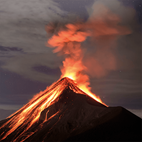 |
Rocks, Relics and Rumbles | 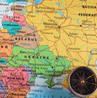 |
Companion project: Our World, Our Planet |
| This project teaches children about the features and characteristics of Earth's layers, including a detailed exploration of volcanic, tectonic and seismic activity. | This essential skills and knowledge project teaches children to locate countries and cities, and use grid references, compass points and latitude and longitude. They learn about the layers of the Earth and plate tectonics and discover the five major climate zones. They learn about significant places in the United Kingdom and carry out fieldwork to discover how land is used in the locality. | ||
| Year 4 | |||
 |
Misty Mountain, Winding River |  |
Interconnected World |
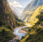
| This project teaches children about the characteristics and features of rivers and mountain ranges around the world, including a detailed exploration of the ecosystems and processes that shape them and the land around them. | This essential skills and knowledge project teaches children about compass points and four and six-figure grid references. They learn about the tropics and the countries, climates and culture of North and South America. Children identify physical features in the United Kingdom and learn about the National Rail and canal networks. They conduct an enquiry to prove a hypothesis, gathering data from maps and surveys before drawing conclusions. | ||
| Year 5 | |||
 |
Sow, Grow, Farm |  |
Companion project: Investigating Our World |
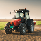
| This project teaches children about the features and characteristics of land use in agricultural regions across the world, including a detailed exploration of significant environmental areas. | This essential skills and knowledge project teaches children about locating map features using a range of methods. They learn about the Prime Meridian, Greenwich Mean Time (GMT), and worldwide time zones and study interconnected climate zones, vegetation belts and biomes. Children learn about human geography and capital cities worldwide before looking at the UK motorway network and settlements. They carry out an enquiry to identify local settlement types. | ||
| Year 6 | |||
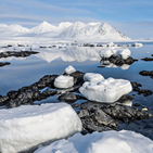 |
Frozen Kingdoms | 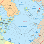 |
Our Changing World |
| This project teaches children about the characteristics and features of polar regions, including the North and South Poles, and includes a detailed exploration of the environmental factors that shape and influence them. | This essential skills and knowledge project revises the features of Earth, time zones and lines of latitude and longitude to pinpoint places on a map. Children find out more about map scales, grid references, contour lines and map symbols. They learn about climate change and the importance of global trade. Children analyse data and carry out fieldwork to find out about local road safety. They study patterns of human settlements and carry out an enquiry to describe local settlement patterns. | ||
 Our curriculum pedagogy is based on four distinct stages (known as the Four Cornerstones) which aim to give clear direction – through a carefully sequenced, interconnected and knowledge-rich planning sequence – for both teaching and learning: Engage – Develop – Innovate - Express
- Engage in memorable experiences that stimulate children’s curiosity, leading them to ask questions and talk about their prior learning.
- Develop new skills and knowledge by delving deeply into a theme, where children make links, create, explore, make, read and write.
- Innovate by returning to prior knowledge and skills so that children can use and apply these in new contexts (in and out of school).
- Express what has been learned by providing opportunities for children to reflect, test their knowledge and celebrate their achievements.
Following our Cornerstones Curriculum, we use quality-assured lesson resources, knowledge organisers, quizzes and question sheet to further support children’s developing geographical subject knowledge. The resources contain the essential facts that children need for each geography topic, and the quizzes and question sheets are used to assess the children’s understanding.
Our curriculum provides opportunities to see what knowledge children have retained and what skills they have mastered through clear curriculum endpoints which help teachers to make judgments about each child’s progress and attainment. Typically, at the end of each unit, children will complete an assessment that takes the form of a short quiz/ series of questions – this is known as an express task. This provides a summative insight that is used alongside outcomes and pupil voice to assess what has been learned.
We want our pupils to develop a love for geography and as a result remind them, if they continue to aim high, as a geographer, they could become a Land surveyor, Forester, Marine Biologist, Weather Presenter, Tour Guide and many other exciting professions!

Cornerstones Curriculum
We provide a creative curriculum based around the Cornerstones Curriculum, a nationally recognised approach for delivering outstanding learning opportunities for children.
What is the Cornerstones Curriculum?
The Cornerstones Curriculum is a creative and thematic approach to learning that is mapped to the Primary National Curriculum to ensure comprehensive coverage of national expectations. Our new curriculum will be delivered through Imaginative Learning Projects (ILPs) which will provide a rich menu of exciting and motivating learning activities that make creative links between all aspects of our children’s learning.
We believe children learn better when they are encouraged to use their imagination and apply their learning to engaging contexts. Our new curriculum will provide lots of learning challenges throughout the academic year that will require children to solve problems, apply themselves creatively and express their knowledge and understanding effectively across the curriculum.
Cornerstones also provide a rigorous essential skills framework that outlines the end of year expectations in all subjects. These essential skills are tied to activities and are age related so that staff can track children’s progress and identify their individual learning needs.
How it Works?
Children will progress through four stages of learning in each ILP – Engage, Develop, Innovate and Express. To find out more about these stages please click on the link through to Cornerstones website:
https://cornerstoneseducation.co.uk/why-cornerstones/
Please find downloadable PDF versions of the Information available for the Geography Curriculum.
Humankind
| Reception | Year 1 | Year 2 | Year 3 | Year 4 | Year 5 | Year 6 |
| Humankind | ||||||
| Human features and landmarks | ||||||
| Human features of the immediate environment include the school, the playground, streets and houses. Notice and begin to name different man-made features in the immediate environment, including the school grounds, local streets and the place they live. | Human features are man-made and include houses, shops, buildings, offices, parks, streets and places of worship. Name and talk about man-made features in the local environment, including shops, houses, streets and parks. | Human features are man-made and include factories, farms, houses, offices, ports, harbours and shops. Landmarks and monuments are features of a landscape, city or town that are easily seen and recognised from a distance. They also help someone to establish and describe a location. Name and describe the purpose of human features and landmarks. | Human features are man-made and include castles, towers, schools, hospitals, bridges, shops, tunnels, monuments, airports and roads. People use human features in different ways. For example, an airport can be used for work or leisure and a harbour can be used for industry or travel. Use geographical vocabulary to describe how and why people use a range of human features. | Services include banks, post offices, hospitals, public transport and garages. Land use types include leisure, housing, industry, transport and agriculture. Describe the type, purpose and use of different buildings, monuments, services and land, and identify reasons for their location. | Human features can be interconnected by function, type and transport links. Describe a range of human features and their location and explain how they are interconnected. | Transport networks can be tangible, such as rails, roads or canals, or intangible, such as air and sea corridors. These networks link places together and allow for the movement of people and goods. Transport networks are usually built where there is a high demand for the movement of people or goods. They run between places where journeys start or finish, such as airports, bus stations, ferry terminals or railway stations. Describe and explain the location, purpose and use of transport networks across the UK and other parts of the world. |
| Settlements and land use | ||||||
| Say how two places in the immediate environment are the same or different. | Describe a contrasting environment to their own. | A settlement is a place where people live and work and can be big or small, depending on how many people live there. Towns and cities are urban settlements. Features of towns and cities include homes, shops, roads and offices. Identify the characteristics of a settlement. | Industries are businesses that make things, sell things and help people live their everyday lives. Land can be used for recreational, transport, agricultural, residential and commercial purposes, or a mixture of these. Describe the size, location and function of a local industry. | Different types of settlement include rural, urban, hamlet, town, village, city and suburban areas. A city is a large settlement where many people live and work. Residential areas surrounding cities are called suburbs. Describe the type and characteristics of settlement or land use in an area or region. | Land uses include agricultural, recreational, housing and industry. Water systems are used for transport, industry, leisure and power. Explain ways that settlements, land use or water systems are used in the UK and other parts of the world. | Agricultural land use in the UK can be divided into three main types, arable (growing crops), pastoral (livestock) and mixed (arable and pastoral). An allotment is a small piece of land used to grow fruit, vegetables and flowers. A wide variety of crops are farmed in the UK, such as wheat, barley, oats, potatoes, other vegetables, fruits and oilseed rape. A wide variety of livestock are reared on farms in the UK, such as sheep, dairy cattle, beef cattle, poultry and pigs. Describe in detail the different types of agricultural land use in the UK. |
Processes
| Reception | Year 1 | Year 2 | Year 3 | Year 4 | Year 5 | Year 6 |
| Processes | ||||||
| Climate and weather | ||||||
| There are four seasons in the United Kingdom: spring, summer, autumn and winter. Each season has typical weather patterns. Record observations about the way the local environment changes throughout each season. | There are four seasons in the UK: spring, summer, autumn and winter. Each season has typical weather patterns. Types of weather include sun, rain, wind, snow, fog, hail and sleet. In the United Kingdom, the length of the day varies depending on the season. In winter, the days are shorter. In summer, the days are longer. Symbols are used to show different types of weather. Identify patterns in daily and seasonal weather. | A weather pattern is a type of weather that is repeated. Describe simple weather patterns of hot and cold places. | Excessive precipitation includes thunderstorms, downbursts, tornadoes, waterspouts, tropical cyclones, extratropical cyclones, blizzards and ice storms. Explain how the weather affects the use of urban and rural environments. | Climatic variation describes the changes in weather patterns or the average weather conditions of a country or continent. Explain climatic variations of a country or continent. | Changes to the weather and climate (temperature, weather patterns and precipitation) can affect land use. Farmers living in different countries adapt their farming practices to suit their local climate and landscape. Explain how the climate affects land use. | Climate and extreme weather can affect the size and nature of settlements, shelters and buildings, diet, lifestyle (settled or nomadic), jobs, clothing, transport and transportation links and the availability of natural resources. Evaluate the extent to which climate and extreme weather affect how people live. |
| Physical processes | ||||||
| All types of weather can affect the environment and how we use it. For example, on sunny days, people might go to the park or the coastline. On cold, icy days, roads and rivers can be frozen. Describe how different types of weather affect the local environment. | Weather is a physical process. Describe in simple terms how a physical process or human behaviour has affected an area, place or human activity. | Erosion is a physical process that involves the weathering and movement of natural materials, such as rock, sand and soil. Erosion is caused by wind and water, including waves, floods, rivers and rainfall. Describe, in simple terms, the effects of erosion. | Volcanic eruptions and earthquakes happen when two tectonic plates push into each other, pull apart from one another or slide alongside each other. The centre of an earthquake is called the epicentre. Explain the physical processes that cause earthquakes and volcanic eruptions. | Water cannot be made. It is constantly recycled through a process called the water cycle. The four stages of the water cycle are evaporation, condensation, precipitation and collection. During the water cycle, water changes state due to heating and cooling. Use specific geographical vocabulary and diagrams to explain the water cycle. | Soil fertility, drainage and climate influence the placement and success of agricultural land. Describe how soil fertility, drainage and climate affect agricultural land use. | Physical processes that can affect a landscape include erosion by wind, water or ice; the deposition of stone and silt by water and ice; land movement, such as landslides and tectonic activity, such as earthquakes or volcanic eruptions. Describe the physical processes, including weather, that affect two different locations. |
Investigation
| Reception | Year 1 | Year 2 | Year 3 | Year 4 | Year 5 | Year 6 |
| Investigation | ||||||
| Geographical resources | ||||||
| Maps and photographs can be used to show key features of the local environment. Use photographs and maps to identify and describe human and physical features from their locality. | An aerial photograph or plan perspective shows an area of land from above. Identify features and landmarks on an aerial photograph or plan perspective. | An aerial photograph can be vertical (an image taken directly from above) or oblique (an image taken from above and to the side). Study aerial photographs to describe the features and characteristics of an area of land. | Maps, globes and digital mapping tools can help to locate and describe significant geographical features. Analyse maps, atlases and globes, including digital mapping, to locate countries and describe features studied. | An atlas is a collection of maps and information that shows geographical features, topography, boundaries, climatic, social and economic statistics of an area. Study and draw conclusions about places and geographical features using a range of geographical resources, including maps, atlases, globes and digital mapping. | Aerial photography is used in cartography, land-use planning and environmental studies. It can be used alongside maps to find out detailed information about a place, or places. Analyse and compare a place, or places, using aerial photographs. atlases and maps. | Satellite images are photographs of Earth taken by imaging satellites. Use satellite imaging and maps of different scales to find out geographical information about a place. |
| Data analysis | ||||||
| Geographical information can be collected by using simple tally charts and pictograms. Begin to collect simple geographical data during fieldwork activities. | Data is information that can be collected and used to answer a geographical question. Collect simple data during fieldwork activities. | Data can be recorded in different ways, including tables, charts and pictograms. Collect and organise simple data in charts and tables from primary sources (fieldwork and observation) and secondary sources (maps and books). | Primary data includes information gathered by observation and investigation. Analyse primary data, identifying any patterns observed. | Secondary data includes information gathered by geographical reports, surveys, maps, research, books and the internet. Collect and analyse primary and secondary data, identifying and analysing patterns and suggesting reasons for them. | Geographical data, such as demographics or economic statistics, can be used as evidence to support conclusions. Summarise geographical data to draw conclusions. | Data helps us to understand patterns and trends but sometimes there can be variations due to numerous factors (human error, incorrect equipment, different time frames, different sites, environmental conditions and unexplained anomalies). Analyse and present increasingly complex data, comparing data from different sources and suggesting why data may vary. |
| Fieldwork | ||||||
| Fieldwork includes going on walks and visits to collect information about the environment. Take photographs, draw simple picture maps and collect simple data during fieldwork activities. | Fieldwork includes going out in the environment to look, ask questions, take photographs, take measurements and collect samples. Carry out fieldwork tasks to identify characteristics of the school grounds or locality. | Fieldwork can help to answer questions about the local environment and can include observing or measuring, identifying or classifying and recording. Ask and answer simple geographical questions through observation or simple data collection during fieldwork activities. | The term geographical evidence relates to facts, information and numerical data. Gather evidence to answer a geographical question or enquiry. | Fieldwork techniques, such as sketch maps, data collection and digital technologies, can provide evidence to support and answer a geographical hypothesis. Investigate a geographical hypothesis using a range of fieldwork techniques. | A geographical enquiry can help us to understand the physical geography (rivers, coasts, weather and rocks) or human geography (population changes, migration, land use, changes to inner city, urbanisation, developments and tourism) of an area and the impacts on the surrounding environment. Construct or carry out a geographical enquiry by gathering and analysing a range of sources. | Representing, analysing, concluding, communicating, reflecting and responding are helpful strategies to answer geographical questions. Ask and answer geographical questions and hypotheses using a range of fieldwork and research techniques. |
Materials
| Reception | Year 1 | Year 2 | Year 3 | Year 4 | Year 5 | Year 6 |
| Materials | ||||||
| Natural and man-made materials | ||||||
| Natural materials include wood, stone and sand. Man-made materials include metal, plastic, glass and fabric. Materials can be used to build and make things. Name some natural and man-made materials in the environment. | A material is something used to build or make something else. Natural materials are dug out of the ground, grown or taken from a living thing. Man-made materials are often made from natural materials but have been changed to have different properties. Identify natural and man-made materials in the environment. | Materials found in the environment can be natural (rock, stone, water, sand, soil, water and clay) and man-made (brick, glass, plastic and concrete). Natural and man-made materials are used to make human features. Describe the properties of natural and man-made materials and where they are found in the environment. | There are three main types of rock found in the Earth's crust. They are sedimentary, igneous and metamorphic. Sedimentary rocks are made from sediment that settles in water and becomes squashed over a long time to form rock. They are often soft, permeable, have layers and may contain fossils. Igneous rocks are made from cooled magma or lava. They are usually hard, shiny and contain visible crystals. Metamorphic rocks are formed when existing rocks are heated by the magma under the Earth’s crust or squashed by the movement of the Earth’s tectonic plates. They are usually very hard and often shiny. Name and describe the types, appearance and properties of rocks. | Rivers transport materials in four ways. Solution is when minerals are dissolved and carried in the water. Suspension is when fine, light material is carried. Saltation is when small pebbles and stones are carried along the riverbed. Traction is when large boulders and rocks are rolled along the riverbed. Describe and explain the transportation of materials by rivers.
Different types of soil include clay, sandy, silty and loamy. Describe the properties of different types of soil. |
The topography of an area intended for agricultural purposes is an important consideration. In particular, the topographical slope or gradient plays a large part in controlling hydrology (water) and potential soil erosion. Explain how the topography and soil type affect the location of different agricultural regions. | The polar oceans are significantly colder than other world oceans. This influences the presence of sea ice, glaciers and icebergs. Explain how the presence of ice makes the polar oceans different to other oceans on Earth. |
Nature
| Reception | Year 1 | Year 2 | Year 3 | Year 4 | Year 5 | Year 6 |
| Nature | ||||||
| Physical features | ||||||
| Large physical features include rivers, mountains, oceans and the coastline. Name some common physical features in the locality and beyond. | Physical features are naturally-created features of the Earth. Use basic geographical vocabulary to identify and describe physical features, such as beach, cliff, coast, forest, hill, mountain, sea, ocean, river, soil, valley and vegetation. | A physical feature is one that forms naturally, and can change over time due to weather and other forces. Describe the size, location and position of a physical feature, such as beach, cliff, coast, forest, hill, mountain, sea, ocean, river, soil, valley and vegetation. | A volcano is an opening in the Earth’s surface from which gas, hot magma and ash can escape. They are usually found at meeting points of the Earth's tectonic plates. When a volcano erupts, liquid magma collects in an underground magma chamber. The magma pushes through a crack called a vent and bursts out onto the Earth’s surface. Lava, hot ash and mudslides from volcanic eruptions can cause severe damage. Describe the parts of a volcano or earthquake.
The Earth is made of four different layers. The inner core is made mostly of hot, solid iron and nickel, and the outer core is made of liquid iron and nickel. The mantle is made of solid rock and molten rock called magma. The crust is a thin layer of solid rock that is broken into large pieces called tectonic plates. These pieces move very slowly across the mantle. Name and describe properties of the Earth’s four layers. |
Mountains form over millions of years. They are made when the Earth’s tectonic plates push together or move apart. Mountains are also formed when magma underneath the Earth’s crust pushes large areas of land upwards. There are five types of mountain: fold, fault-block, volcanic, dome and plateau. Identify, describe and explain the formation of different mountain types. | North America is broadly categorised into six major biomes: tundra, coniferous forest, grasslands (prairie), deciduous forest, desert and tropical rainforest. South America has a vast variety of biomes, including desert, alpine, rainforest and grasslands. Identify and describe some key physical features and environmental regions of North and South America and explain how these, along with the climate zones and soil types, can affect land use. | The Arctic is a sea of ice surrounded by land and located at the highest latitudes of the Northern Hemisphere. It extends over the countries that border the Arctic Ocean, including Canada, the USA, Denmark, Russia, Norway and Iceland. Antarctica is a continent located in the Southern Hemisphere. Antarctica does not belong to any country. Physical features typical of the Arctic and Antarctic regions include glaciers, icebergs, ice caps, ice sheets, ice shelves and sea ice. Compare and describe physical features of polar landscapes. |
| Environment | ||||||
| Litter has a harmful effect on the areas where we live, work and play. People need to put their rubbish into the bin and not throw it on the ground. Describe ways to look after the immediate environment. | Litter and pollution have a harmful effect on the areas where we live, work and play. Describe how pollution and litter affect the local environment and school grounds. | The local environment can be improved by picking up litter, planting flowers and improving amenities. Describe ways to improve the local environment. | The Earth has five climate zones: desert, Mediterranean, polar, temperate and tropical. Identify the five major climate zones on Earth. | Altitudinal zonation describes the different climates and types of wildlife at different altitudes on mountains. Examples include forests that grow at low altitudes and support a wide variety of plants and animals, tundra that is found at higher altitudes and supports plants and animals that are adapted to harsher environments, and the summits of mountains, which are usually in ice and snow and don't support any life. Describe altitudinal zonation on mountains. | The Earth has five climate zones: desert, Mediterranean, polar, temperate and tropical. Mountains have variable climates depending on altitude. A biome is a large ecological area on the Earth's surface, such as desert, forest, grassland, tundra and aquatic. Biomes are often defined by a range of factors, such as temperature, climate, relief, geology, soils and vegetation. Name and locate the world’s biomes, climate zones and vegetation belts and explain their common characteristics. | Climate change is the long-term change in expected patterns of weather that contributes to the melting of polar ice caps, rising sea levels and extreme weather. Climate change is caused by global warming. Human activity, such as burning fossil fuels, deforestation, habitat destruction, overpopulation and rearing livestock, all contribute to global warming. Explain how climate change affects climate zones and biomes across the world. |
| Sustainability | ||||||
| Natural environments can be affected by the actions of humans, including cutting down trees or dropping litter. Humans can protect the environment by choosing to preserve woodlands and hedgerows, recycling where possible and disposing of waste carefully. Describe ways to protect natural environments, such as woodlands, hedgerows and meadows. | Conservation is the protection of living things and the environment from damage caused by human activity. Conservation activities include reducing, reusing and recycling, composting, saving water and saving energy. Conservation activities protect the environment for people in the future. Describe how human behaviour can be beneficial to local and global environments, now and in the longer term. | A person’s carbon footprint is the amount of carbon dioxide released into the atmosphere from their activities. People can reduce their carbon footprint by driving less, eating less meat, flying less and wasting less food and products. Describe the meaning of the term ‘carbon footprint’ and explain some of the ways this can be reduced to protect the environment. | The environment produces natural resources. Humans use some natural resources to make energy. Some natural resources cannot be replaced, like coal or oil. They are non-renewable. Some, like wind or flowing water, are renewable sources of energy. Describe how natural resources can be harnessed to create sustainable energy. | Industries can make their manufacturing processes more sustainable and better for the environment by using renewable energy sources, reducing, reusing and recycling and sharing resources. Identify and explain ways that people can improve the production of products without compromising the needs of future generations. | Natural resource management (NRM) manages natural resources, including water, land, soil, plants and animals. It recognises that people rely on healthy landscapes to live and aims to create sustainable ways of using land now and in the future. Explain the significance of human-environment relationships and how natural resource management can protect natural resources to support life on Earth. | |
Place and Space
| Reception | Year 1 | Year 2 | Year 3 | Year 4 | Year 5 | Year 6 |
| Place and Space | ||||||
| World | ||||||
| Globes and maps can show us the location of different places around the world. Begin to notice and talk about the different places around the world, including oceans and seas. | A continent is a large area of land. The world's seven continents are Africa, Antarctica, Asia, Australia, Europe, North America and South America. The five oceans are the Arctic Ocean, Atlantic Ocean, Indian Ocean, Pacific Ocean and Southern Ocean. Name and locate the world's seven continents and five oceans on a world map. | An ocean is a large sea. There are five oceans on our planet called the Arctic, Atlantic, Indian, Pacific and Southern Oceans. Seas include the Black, Red and Caspian Seas. The United Kingdom is an island surrounded by the Atlantic Ocean, English Channel, Irish Sea and North Sea. The world's seven continents are Africa, Antarctica, Asia, Australia, Europe, North America and South America. Name and locate seas surrounding the UK, as well as seas, the five oceans and seven continents around the world on a world map or globe. | Countries in Europe include the United Kingdom, France, Spain, Germany, Italy and Belgium. Russia is part of both Europe and Asia. Locate countries and major cities in Europe (including Russia) on a world map. | The North American continent includes the countries of the USA, Canada and Mexico as well as the Central American countries of Guatemala, Honduras, Nicaragua, Costa Rica and Panama. The South American continent includes the countries of Brazil, Argentina, Chile, Colombia, Peru, Venezuela, Uruguay, Ecuador, Bolivia and Paraguay. Locate the countries and major cities of North, Central and South America on a world map, atlas or globe. | Major cities around the world include London in the UK, New York in the USA, Shanghai in China, Istanbul in Turkey, Moscow in Russia, Manila in the Philippines, Lagos in Nigeria, Nairobi in Kenya, Baghdad in Iraq, Damascus in Syria and Mecca in Saudi Arabia. Name, locate and describe major world cities. | Geographical interconnections are the ways in which people and things are connected. Explain interconnections between two or more areas of the world. |
| UK | ||||||
| Identify the United Kingdom on a world map or globe. | The United Kingdom (UK) is a union of four countries: England, Northern Ireland, Scotland and Wales. A capital city is a city that is home to the government and ruler of a country. London is the capital city of England, Belfast is the capital city of Northern Ireland, Edinburgh is the capital city of Scotland and Cardiff is the capital city of Wales. The countries of the United Kingdom are made up of cities, towns and villages. Name and locate the four countries of the UK and their capital cities on a map, atlas or globe. | The characteristics of countries include their size, landscape, capital city, language, currency and key landmarks. England is the biggest country in the United Kingdom. Identify characteristics of the four countries and major cities of the UK. | Counties of the United Kingdom include Derbyshire, Sussex and Warwickshire. Major cities of the United Kingdom include London, Birmingham, Edinburgh, Cardiff, Manchester and Newcastle. Name, locate and describe some major counties and cities in the UK. | Significant rivers of the UK include the Thames, Severn, Trent, Dee, Tyne, Ouse and Lagan. Significant mountains and mountain ranges include Ben Nevis, Snowdon, Helvellyn, Pen y Fan, the Scottish Highlands and the Pennines. Create a detailed study of geographical features including hills, mountains, coasts and rivers of the UK.
Topography is the arrangement of the natural and artificial physical features of an area. Identify the topography of an area of the UK using contour lines on a map. |
Relative location is where something is found in comparison with other features. Describe the relative location of cities, counties or geographical features in the UK in relation to other places or geographical features. | A geographical pattern is the arrangement of objects on the Earth’s surface in relation to one another. Describe patterns of human population growth and movement, economic activities, space, land use and human settlement patterns of an area of the UK or the wider world. |
| Location | ||||||
| Describe how the weather, plants and animals of one place is different to another using simple geographical terms. | Warmer areas of the world are closer to the equator and colder areas of the world are further from the equator. The equator is an imaginary line that divides the Earth into two parts: the Northern and Southern Hemispheres. Continents have different climates depending on where they are in the world. The climate of a place can be identified by the types of weather, plants and animals found there. Locate hot and cold areas of the world in relation to the equator. | The equator is an imaginary line that divides the world into the Northern and Southern Hemispheres. The North Pole is the most northern point on Earth. The South Pole is the most southern point on Earth. Locate the equator and the North and South Poles on a world map or globe. | Latitude is the distance north or south of the equator and longitude is the distance east or west of the Prime Meridian. Locate significant places using latitude and longitude. | The Tropic of Cancer is 23 degrees north of the equator and Tropic of Capricorn is 23 degrees south of the equator. Identify the location of the Tropics of Cancer and Capricorn on a world map. | The Prime (or Greenwich) Meridian is an imaginary line that divides the Earth into eastern and western hemispheres. The time at Greenwich is called Greenwich Mean Time (GMT). Each time zone that is 15 degrees to the west of Greenwich is another hour earlier than GMT. Each time zone 15 degrees to the east is another hour later. Identify the location and explain the function of the Prime (or Greenwich) Meridian and different time zones (including day and night). | The Northern Hemisphere is the part of Earth that is to the north of the equator. The Southern Hemisphere is the part of Earth that is to the south of the equator. The Prime Meridian is the imaginary line from the North Pole to the South Pole that passes through Greenwich in England and marks 0° longitude, from which all other longitudes are measured. Identify the position and explain the significance of latitude, longitude, equator, Northern Hemisphere, Southern Hemisphere, the Tropics of Cancer and Capricorn, the Arctic and Antarctic Circles, the Prime (or Greenwich) Meridian and time zones (including day and night). |
| Position | ||||||
| Positional language is used to describe where things are in relation to one another. Positional language includes in, on, next to, behind, in front of, in between, above, below and underneath. Use simple positional language to describe where things are in relation to each other and give directions. | Positional language includes behind, next to and in front of. Directional language includes left, right, straight ahead and turn. Use simple directional and positional language to give directions, describe the location of features and discuss where things are in relation to each other. | The four cardinal points on a compass are north, south, east and west. A route is a set of directions that can be used to get from one place to another. Use simple compass directions to describe the location of features or a route on a map. | The eight points of a compass are north, south, east, west, north-east, north-west, south-east and south-west. Use the eight points of a compass to locate a geographical feature or place on a map. | The four cardinal directions are north (N), east (E), south (S) and west (W), which are at 90° angles on the compass rose. The four intercardinal (or ordinal) directions are halfway between the cardinal directions: north-east (NE), south-east (SE), south-west (SW) and north-west (NW). Use the eight points of a compass, four and six-figure grid references, symbols and a key to locate and plot geographical places and features on a map. | Compass points can be used to describe the relationship of features to each other, or to describe the direction of travel. Accurate grid references identify the position of key physical and human features. Use compass points, grid references and scale to interpret maps, including Ordnance Survey maps, with accuracy. | Invisible lines of latitude run horizontally around the Earth and show the northerly or southerly position of a geographical area. Invisible lines of longitude run vertically from the North to the South Pole and show the westerly or easterly position of a geographical area. Use lines of longitude and latitude or grid references to find the position of different geographical areas and features. |
| Maps | ||||||
| A map is a picture or drawing of an area of land or sea. Make and use simple maps in their play to represent places and journeys, real and imagined. | A map is a picture or drawing of an area of land or sea that can show human and physical features. A key is used to show features on a map. A map has symbols to show where things are located. Draw or read a simple picture map. | A map is a picture or drawing of an area of land or sea that can show human and physical features. Maps use symbols and a key. A key is the information needed to read a map and a symbol is a picture or icon used to show a geographical feature. Draw or read a range of simple maps that use symbols and a key. | A four-figure grid reference contains four numbers. The first two numbers are called the easting and are found along the top and bottom of a map. The second two numbers are called the northing and are found up both sides of a map. Four-figure grid references give specific information about locations on a map. Use four-figure grid references to describe the location of objects and places on a simple map. | A six-figure grid reference contains six numbers and is more precise than a four-figure grid reference. The first three figures are called the easting and are found along the top and bottom of a map. The second three figures are called the northing and are found up both sides of a map. Six-figure grid references give detailed information about locations on a map. Use four or six-figure grid references and keys to describe the location of objects and places on a map. | The geographical term 'relief' describes the difference between the highest and lowest elevations of an area. Relief maps show the contours of land based on shape and height. Contour lines show the elevation of the land, joining places of the same height above sea level. They are usually an orange or brown colour. Contour lines that are close together represent ground that is steep. Contour lines that are far apart show ground that is gently sloping or flat. Identify elevated areas, depressions and river basins on a relief map. | A geographical area can be understood by using grid references and lines of latitude and longitude to identify position, contour lines to identify height above sea level and map symbols to identify physical and human features. Use grid references, lines of latitude and longitude, contour lines and symbols in maps and on globes to understand and record the geography of an area. |
Change
| Reception | Year 1 | Year 2 | Year 3 | Year 4 | Year 5 | Year 6 |
| Change | ||||||
| Geographical change | ||||||
| Discuss how the local environment has changed over time using photographs and first-hand experiences. | Geographical features can change over time. Describe how a place or geographical feature has changed over time. | An environment or place can change over time due to a geographical process, such as erosion, or human activity, such as housebuilding. Describe how an environment has or might change over time. | Significant geographical activity includes earthquakes and volcanic eruptions. These are known as natural disasters because they are created by nature, affect many people and cause widespread damage. Describe how a significant geographical activity has changed a landscape in the short or long term.
The crust of the Earth is divided into tectonic plates that move. The place where plates meet is called a plate boundary. Plates can push into each other, pull apart or slide against each other. These movements can create mountains, volcanoes and earthquakes. Describe the activity of plate tectonics and how this has changed the Earth’s surface over time (continental drift). |
Rivers, seas and oceans can transform a landscape through erosion, deposition and transportation. Explain how the physical processes of a river, sea or ocean have changed a landscape over time. | Settlements come in many different sizes and these can be ranked according to their population and the level of services available. A settlement hierarchy includes hamlet, village, town, city and large city. Describe how the characteristic of a settlement changes as it gets bigger (settlement hierarchy). | Tourism is an industry that involves people travelling for recreation and leisure. It has had an environmental, social and economic impact on many regions and countries. Present a detailed account of how an industry, including tourism, has changed a place or landscape over time. |
| Our agreed consistencies for Geography: | If you were to walk into a Geography lesson at Sandhurst you would see: | In our Geography curriculum you will see that we value inclusion and diversity: |
|
|
|